The Challenge
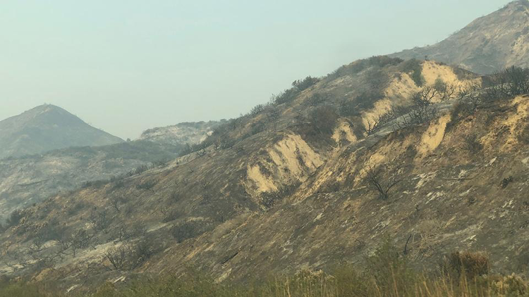
Southern California experienced a significant drought from 2012 to 2016, which was exacerbated by warming due to climate change. Defined by unprecedented high temperatures and low annual precipitation, it was the driest four-year span in the last 1,200 years. As a result, overall vegetation health and cover has most likely been affected (e.g. decline in greenness, high vegetation mortality in chaparral-dominated communities). Changes in vegetation health and cover create favorable conditions for wildfires and landslides. These changes threaten both the stability of the natural environment and the structures that depend on it, such as built electricity generation plants, power lines and pipelines. Because these types of infrastructure are often located on or run through wildland areas, changes in vegetation, wildfires and landslides can impact the region’s energy supplies. To better understand these impacts and assess Los Angeles County’s energy supply vulnerabilities, researchers analyzed the impacts of the 2012-2016 drought on vegetation health and cover using satellite and geospatial environmental data.
The Solution
Researchers address the impacts of the 2012-2016 drought on habitat and energy infrastructure in Los Angeles County. They utilized satellite data and Normalized Difference Vegetation Index (NDVI) to examine temporal “browning,” or decrease in greenness due to drought. They determined areas and vegetation types with differing degrees of browning to assess the implications of climate change for local habitats and energy infrastructure. Remote sensing and Geographical Information System (GIS) were also incorporated to analyze relationships between the patterns of vegetation browning and various environmental factors (e.g. vegetation type, fire and landslide vulnerabilities, soil, topography). The findings of the project will provide tools and metrics to preserve critical habitats while assisting utilities in siting energy infrastructure for enhanced disaster resilience.
Results
- The energy generation/transmission corridors and infrastructures located in the Santa Susana Mountains and the Simi Hills are particularly vulnerable to wildfire hazards. The danger is expected to increase due to more frequent drought-induced fires in the future.
- Vegetation experienced significant browning especially during the winter of 2014. By 2016, overall greenness had not recovered to previous levels.
- Southern coastal-zone vegetation demonstrated exaggerated browning compared to other California vegetation zones. Local environmental factors such as soil type and elevation influenced the sensitivity of vegetation.
Next Steps
This is a pilot project for fine-scaled landscape analysis of drought impacts on vegetation and habitat. The project is a first step in integrating biophysical models to predict and produce future scenarios of the 21st century’s drought impacts. Thus, it has the potential to be applied to other regions or at a larger scale. In 2019, researchers published a study of vegetation responses to the 2012-2016 drought comparing Northern and Southern California.
Publications and Reports
Dong, C., Macdonald, G. M., Willis, K., Gillespie, T. W., Okin, G. S., & Williams, A. P. (2019). Vegetation Responses to 2012–2016 Drought in Northern and Southern California. Geophysical Research Letters, 46(7), 3810-3821. doi:10.1029/2019gl082137

Research Team
Glen MacDonald
Geography, Social Sciences
Institute of the Environment & Sustainability, Water Resources Group
macdonal@geog.ucla.edu
Gregory Okin
Geography, Social Sciences
Institute of the Environment & Sustainability
okin@ucla.edu
Thomas Gillespie
Geography, Social Sciences
Institute of the Environment & Sustainability
tg@geog.ucla.edu
Richard Ambrose
Environmental Health Science, Fielding School of Public Health
Institute of the Environment & Sustainability
rambrose@ucla.edu
Philip Rundel
Ecology and Evolutionary Biology, Life Sciences
Institute of the Environment & Sustainability
rundel@biology.ucla.edu


